Breaking news
New drone surveillance system to be deployed on Canadian Coast Guard Vessels.
According to a news published by Kongsberg Geospatial on February 12, 2021, the firm announced today that it has been selected by Defence Research and Development Canada (DRDC) to conduct trials of a new long-endurance UAV surveillance system for the Canadian Coast Guard. The Martin UAV V-BAT aircraft was selected to provide the unique ability to combine take off and landing from the small confines aboard ship with the long endurance of a fixed-wing aircraft while carrying multiple sensors.
Follow Navy Recognition on Google News at this link
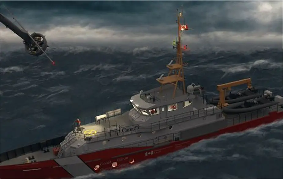
 The future Canadian Coast Guard Vessels (Picture source: Kongsberg Geospatial)
The aircraft will communicate with the Kongsberg Geospatial sensor data management system, called MIDAS, which allows a range of sensor data, including full-motion video from unmanned systems to be processed and exploited in near real-time by analysts on board Canadian Coast Guard ships. MIDAS provides the capability to compare historical and live data from the mission area, and to examine sensor data with a variety of tools, including motion and object detection, in near-real time. This near real-time analytical capability can greatly enhance the effectiveness of UAVs for a variety of mission types.
The V-BAT Unmanned Aerial System (UAS) provided by Martin UAV is a fixed-wing vertical take-off and landing (VTOL) aircraft specifically designed to operate from very small spaces on ships, land, and nearly any environment. The V-BAT is a long-endurance aircraft capable of carrying multiple sensors, including land and maritime wide area surveillance.
Kongsberg Geospatial’s MIDAS is derived from technologies created for the NATO Alliance Ground Surveillance project which required the storage and retrieval of vast amounts of intelligence data for Intelligence Analysts. The system directly addresses the problem that the vast majority of UAVs have no standards-compliant capability to process, exploit, and distribute (PED) their sensor data where it is being used. MIDAS provides a fully standards-compliant system that allows intelligence analysts to view, process, and analyze sensor data in near real-time, from where the drone is being operated. MIDAS has packaged these capabilities into a tactical and portable form factor to enables those surveillance capabilities to be deployed as a portable system on board a ship, or in a temporary command post.
CINTIQS Military Technology Consulting will be providing consulting services for the planning and conduct of the flight trials and sensor employment to validate systems performance.
The combination of the Martin UAV V-BAT and the Kongsberg MIDAS sensor data management system will allow Coast Guard vessels to significantly expand their surveillance range for search and rescue missions, and for the surveillance of the movement of icebergs, without requiring the use of manned aircraft.


